
Stafford Township Neighbors by Parcel
Immediate Stafford Township neighbors are researched through property geometry first. Ocean County GIS and the township tax maps show the nearby parcel pattern. The tax list, assessor viewer, and deed index then answer narrower questions about each parcel. A community-group listing can identify an organization or meeting place, but the township page does not publish member names. Treat owner fields, public voter material, permit leads, and civic affiliations as different categories rather than combining them into a household list.
| Block source | What it can show | Access route |
|---|---|---|
| Ocean County GIS | Parcel boundaries, adjoining geometry, and map layers | Public map browse and parcel click |
| Stafford tax maps | Block, lot, road, easement, and map-sheet geometry | PDF sheets and Assessor office |
| Certified 200-foot list | Nearby named properties and owners for a target parcel | Assessor form, $10, estimated seven business days |
| Ocean tax list | Property location, class, and annual tax context | Municipality, block, lot, and qualifier search |
| Ocean deed index | Transfer parties, legal description, and linked records | Online from April 1, 1977, then office or archive fallback |
Parcel adjacency is not proof that people know one another, share a household, or live on a lot. The property location and the owner's mailing field can differ. A deed can name a person who transferred a parcel in the past. For a current block question, record the map revision date and then compare each result with the exact legal key. That method leaves a clear distinction between the map's shape, the annual tax snapshot, and the recorded transfer.
Note: Stafford Township's block and lot key is more dependable than a guessed run of street numbers when parcels have been subdivided or consolidated.
Stafford Township GIS Block Geometry
The Ocean County GIS map hub supports the geographic part of a neighbor search. Pan and zoom to a street segment, use the identify or parcel click control, and keep the surrounding geometry in view. The county describes parcel, cadastral, easement, right-of-way, imagery, zoning, FEMA flood, tax-map, wetlands, streams, parks, farmland, subdivision, and site-plan layer context. These layers explain why a nearby line on a map may not be a straightforward side-yard boundary.
Capture the property location, block, lot, qualifier, road, visible easement or right-of-way, tax-map sheet, and map revision date before leaving the map. Stafford publishes sheets TM 1 through TM 129 with index and key maps. Dotted lots and qualifiers matter. Deeds can use a legal description instead of the current street address, and parcel geometry can change through subdivision, consolidation, easement, or lot-line adjustment. A map popup is a useful lead, but tax and deed sources are the confirmation route for names.
- Block and lot
- The parcel identifier used in Stafford tax-map and assessment work. A qualifier may further distinguish a parcel.
- Parcel geometry
- The mapped outline and spatial position of a parcel, not a statement about who occupies it.
- Situs address
- The property location. It should be kept separate from an owner's mailing address or a postal label.
Stafford Township Neighbor List Requests
For a defined nearby-property question, Stafford's 200-foot certified-list request is the formal fallback after map research. The form asks for the date, block, lot, qualifier, property location, requester contact, tax-map number, map-copy choice, and delivery method. The Assessor states a $10 fee by check or money order and an estimated seven-business-day turnaround. It is more precise than trying to infer adjoining property from a casual street search.
Use the map to prepare the legal key, then submit the form with the desired target parcel. The returned list is a nearby-property and owner route, not proof of current household membership or consent to contact. If the map and certified list differ, retain both dates and ask the Assessor which record date applies. The Stafford Tax Assessor also provides the local property-card and tax-map access route when an online viewer leaves a needed field unclear.
- Locate the target address in the GIS viewer or tax-map index.
- Write down the block, lot, qualifier, map sheet, and property location exactly as shown.
- Check the map for roads, easements, rights-of-way, or revised parcel lines that change the apparent radius.
- Complete the certified-list form with the required contact and delivery details, then retain the response date with the returned list.
Map a Stafford Township Neighbor Block
A block review works as a documented flow: address to map parcel, parcel to block and lot, block and lot to assessment or tax record, then legal key to deed history. Move one parcel at a time. The map tells you which parcels are spatially adjacent. The assessment record may show owner and mailing fields where visible. The Clerk's index can then be used for a transfer history. Search the owner as a grantee around a likely acquisition date, inspect the document detail or image, and confirm the legal description.
County GIS is not an owner-proof system by itself. Its most useful role is helping you avoid skipping a parcel or confusing an easement with a lot edge. The County Clerk's online index starts April 1, 1977. Earlier transfer work requires a pivot to the Clerk, FamilySearch, the State Archives, or library reference sources. If the question becomes a complete named-street chain rather than an immediate block, use the Stafford Township Street Directory for the address-record workflow.
Note: Compare the tax-map sheet and legal description at every deed link because a subdivision or consolidation can change the block and lot over time.
Stafford Township Neighbor Community Leads
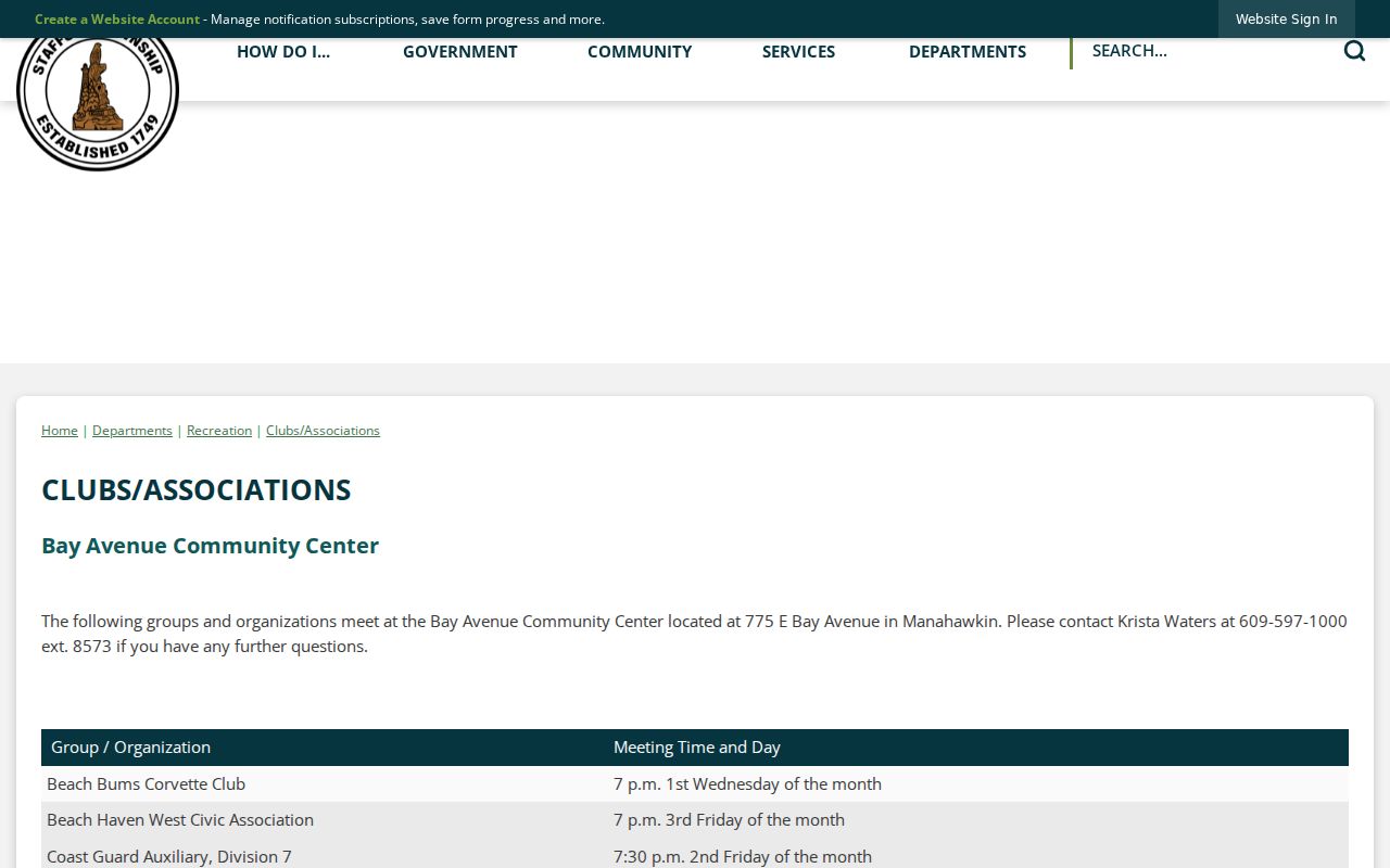
Community information offers a human-use route for learning the names of local organizations, not their members. The township's Clubs and Associations page lists civic groups by facility and provides meeting patterns for some organizations. It is useful for finding a community contact or a dated organization name for newspaper and local-history searches. It does not supply a roster of Stafford Township neighbors, and a group connection should never be used to infer that a particular person lives nearby.
Bay Avenue
Beach Haven West Civic Association, Colony Lakes HOA, Stafford Women's Club, Stafford Old Guard, Stafford Garden Club, and Village Harbor Fishing Club are listed at the Bay Avenue Community Center.
Ocean Acres
The Ocean Acres Community Center listing includes Old Barney Radio Club, Girl Scouts and Boy Scouts Ocean County, and Stafford athletic associations.
Pine Street
The Pine Street Recreation Center listing includes community activities such as bridge, writing, knitting, Mah Jongg, Senior Squares, and Soroptimists.
The township civic-groups listing is the source for these facility-based leads.
Meeting arrangements and contacts can change, so use the listed organization or township page to confirm current details. Community groups may help locate a newsletter or historical reference, but the published page expressly functions as organization information rather than a membership directory.
Compare Stafford Township Neighbor Sources
Official parcel records and commercial neighbor-search products are not equivalent. A government map, tax list, or recorded document has a named custodian, an identifiable record type, and a date or filing context. Commercial tools may combine public filings, licensed data, historical addresses, marketing material, and user-supplied matches. They can be stale, duplicated, or attached to the wrong person. For block research, use an official source image or response as the cited record and treat an unmatched commercial claim as unverified.
| Source category | Strength for nearby-parcel research | Care required |
|---|---|---|
| GIS or tax map | Shows parcel geometry and legal keys | Does not prove ownership or current presence |
| Tax list or assessor source | Provides annual property context and visible fields | Can contain a different mailing field or lawful redaction |
| Recorded deed | Documents dated transfer parties and legal description | Party role and transfer date do not establish present occupancy |
| Commercial compiled result | May offer a lead to independently test | Accuracy, source date, and identity match must be checked |
For a public voter question, the statewide status form is name and month-year based, not a map browse tool. The County Election Board has a formal request route for the fields law permits, and signatures and other protected data remain restricted. That is a separate record class from parcel ownership. Keep the source, date, and legal purpose with each request.
Boundaries for Stafford Township Neighbors
Stafford's geography makes exact labels important. Official township materials use Stafford Township, Stafford, Manahawkin, Mayetta, West Creek, Ocean Acres, Beach Haven West, Cedar Bonnet Island, Stafford Forge, and other locality clues. They are useful search terms, not a complete official neighborhood-boundary system. A postal city or ZIP can differ from the municipality shown in a tax or legal record. Preserve the municipality, property location, mailing address, and postal label as separate fields.
Historical research needs the same care. Manahawkin can appear as Manahohacky, Manahoching, or Manahawken in older sources. No authoritative Stafford street-renumbering or street-renaming table was located in the research. When an older address seems to move, compare tax-map sheet, legal description, old imagery or map material, permit file, and dated directory source. Do not manufacture an address crosswalk from a postal match alone.
Note: Ocean tax-list and sales-search forms use municipality, block, lot, qualifier, class, and property location fields, not a ZIP-wide neighbor search.
Stafford Township Neighbor Privacy Limits
New Jersey OPRA, N.J.S.A. 47:1A-1 et seq., provides a request process but includes exemptions for protected personal information. A parcel system may lawfully show a redacted owner field or protected address. Daniel's Law protects eligible public-safety and judicial residential addresses, and the Address Confidentiality Program provides a substitute address and mail forwarding for qualifying participants. Voter signatures, confidential vital material, motor-vehicle personal information, and many personal identifiers are not ordinary neighbor-search fields.
A public map or deed result does not establish current occupancy, a household relationship, identity, intent, or wrongdoing. For a redaction question, contact the record custodian and identify the record and field. For a suspected deed or property-fraud issue, confirm the document through the Ocean County Clerk; Property Alert can notify a subscriber after verification but cannot prevent fraud. Use official agency numbers, not a number in an unexpected message.
Lawful use. Research Stafford Township neighbors for personal, civic, property, and family-history purposes. Stalking, harassment, intimidation, and repeated unwanted contact are prohibited under New Jersey law.